I am Fee, the first master student who will monitor the exclusion cages in Lac Bay on Bonaire for three months. Continue reading “Guest post: Fee’s research – turtle exclosures Lac Bay”
Satellite trackers show Bonaire green turtle habitat use
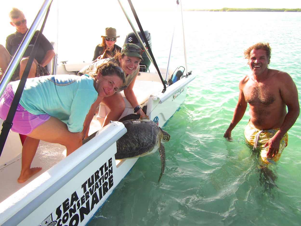
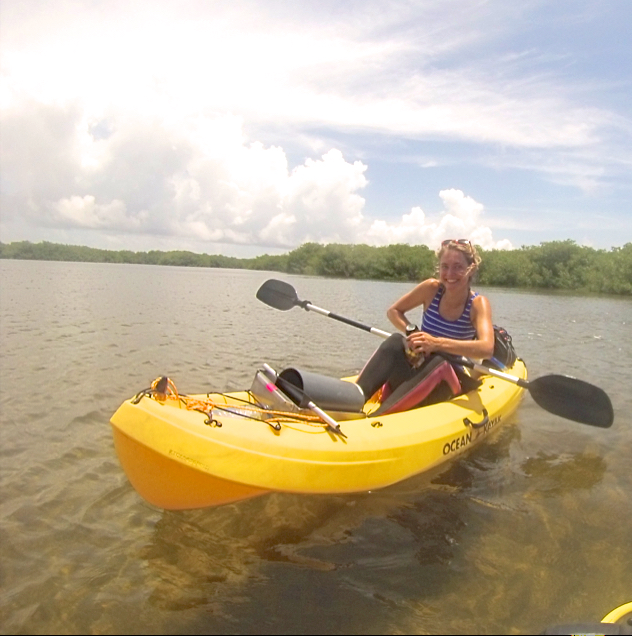
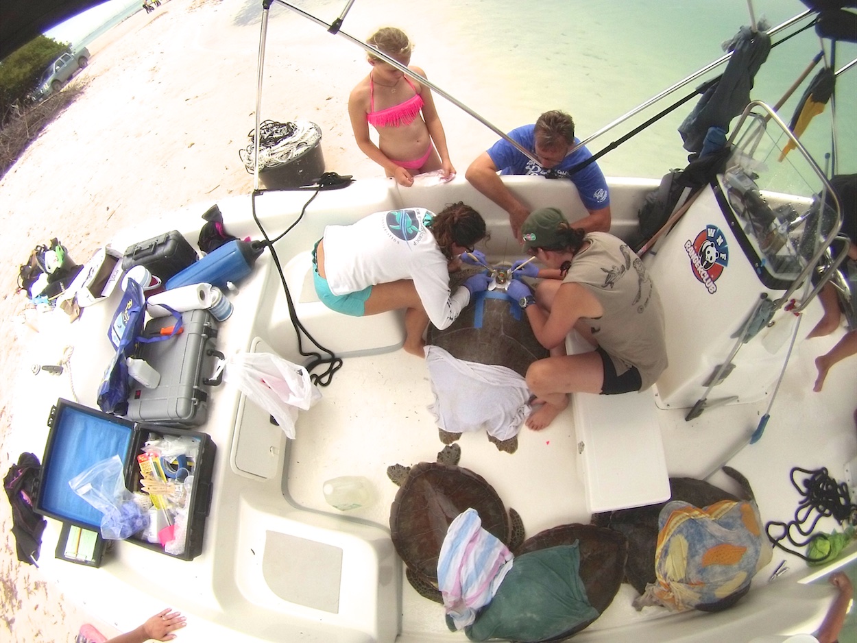
4 sub-adult green turtles that we caught in Lac Bay are now equipped with satellite transmitters to study their movements and use of the seagrass meadows, (see photos below).
The greens that forage in the shallow Lac Bay area are typically sub-adults. Continue reading “Satellite trackers show Bonaire green turtle habitat use”
Experiment on (invasive) seagrass & turtle grazing, Bonaire

Two weeks ago we arrived on Bonaire. Since then we worked non-stop and we made great progress! The first thing we did was to set up a turtle exclosure experiment on the seagrass beds in Lac Bay, after Funchi (STCB) and Sabine Engel (STINAPA) kindly showed us all the suitable seagrass areas. The native dominant seagrass species here are Thalassia testudinum (or turtle grass) and Syringodium filiforme. However after a quick snorkel survey across the bay the cover of invasive seagrass species Halophila stipulacea seems almost higher.
That is impressive since the species was reported only in 2010 for the first time in Lac Bay. NGO Sea Turtle Conservation Bonaire that works since 1991 on turtles here estimates the sea turtle population (green and hawksbill) between 1000-2000 turtles Continue reading “Experiment on (invasive) seagrass & turtle grazing, Bonaire”
Sea turtle fieldwork in Dutch Caribbean 2015

I am very excited to finally start our fieldwork on sea turtles and seagrass in the Bonaire, Aruba and Curacao! What started as a proposal (initiated by Lisa Becking and me) in August 2013, finally resulted in a research project May 2015 entitled “Ecology and conservation of Green and Hawksbill turtles in the Dutch Caribbean”. Continue reading “Sea turtle fieldwork in Dutch Caribbean 2015”
12.000 stable isotope samples of the Wadden Sea
Who eats who in the Wadden Sea? We collected 12000 samples in one of the largest dbases of stable isotope samples. Using these samples we found that the energy in the Wadden Sea (primary production) is mainly provided by the production of benthic algae (diatoms) on the tidal flats. Papers about this are underway but the first results can be found in our scientific report & glossy
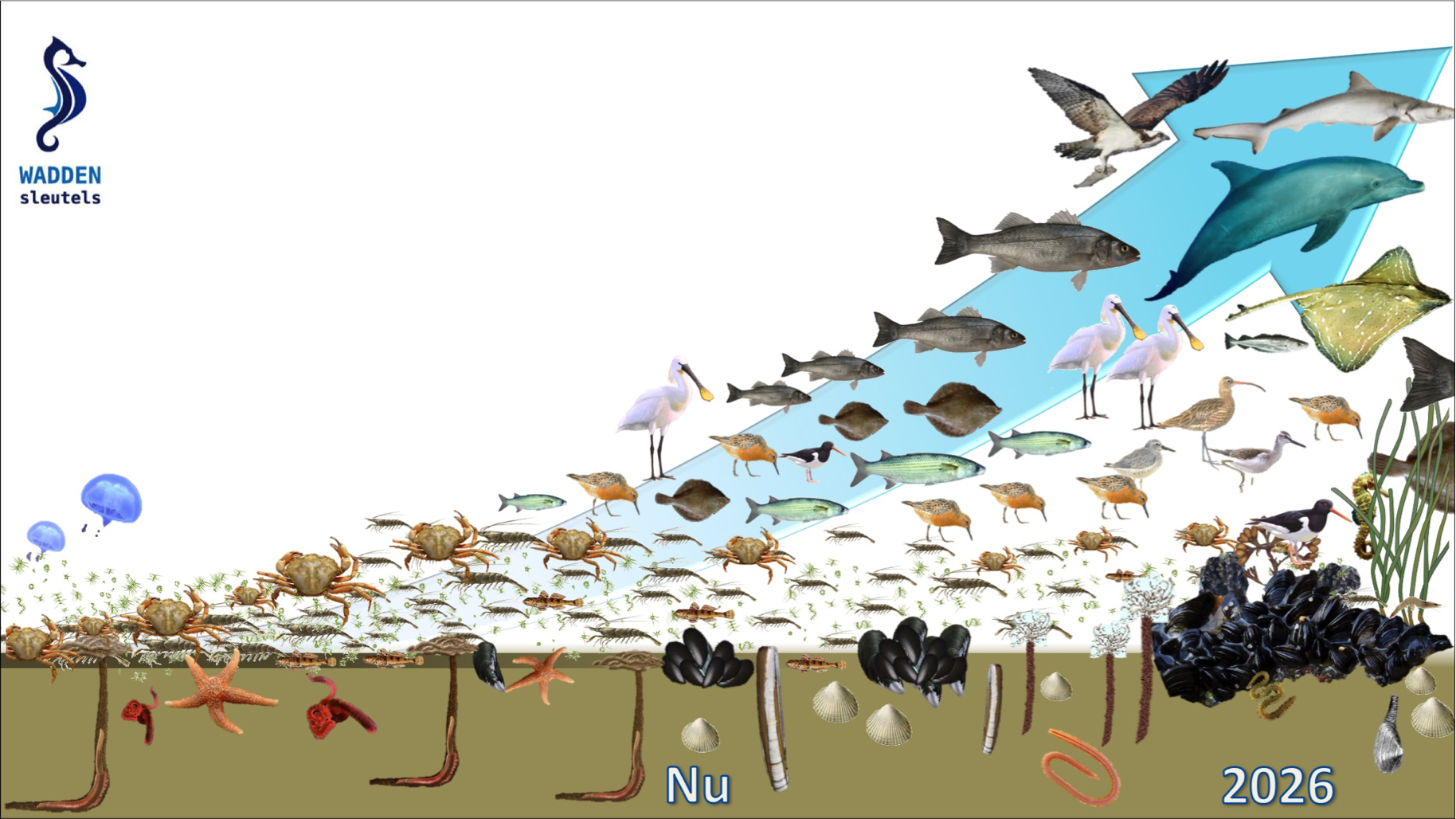
Now online: “Wadden Natuur Kaart”
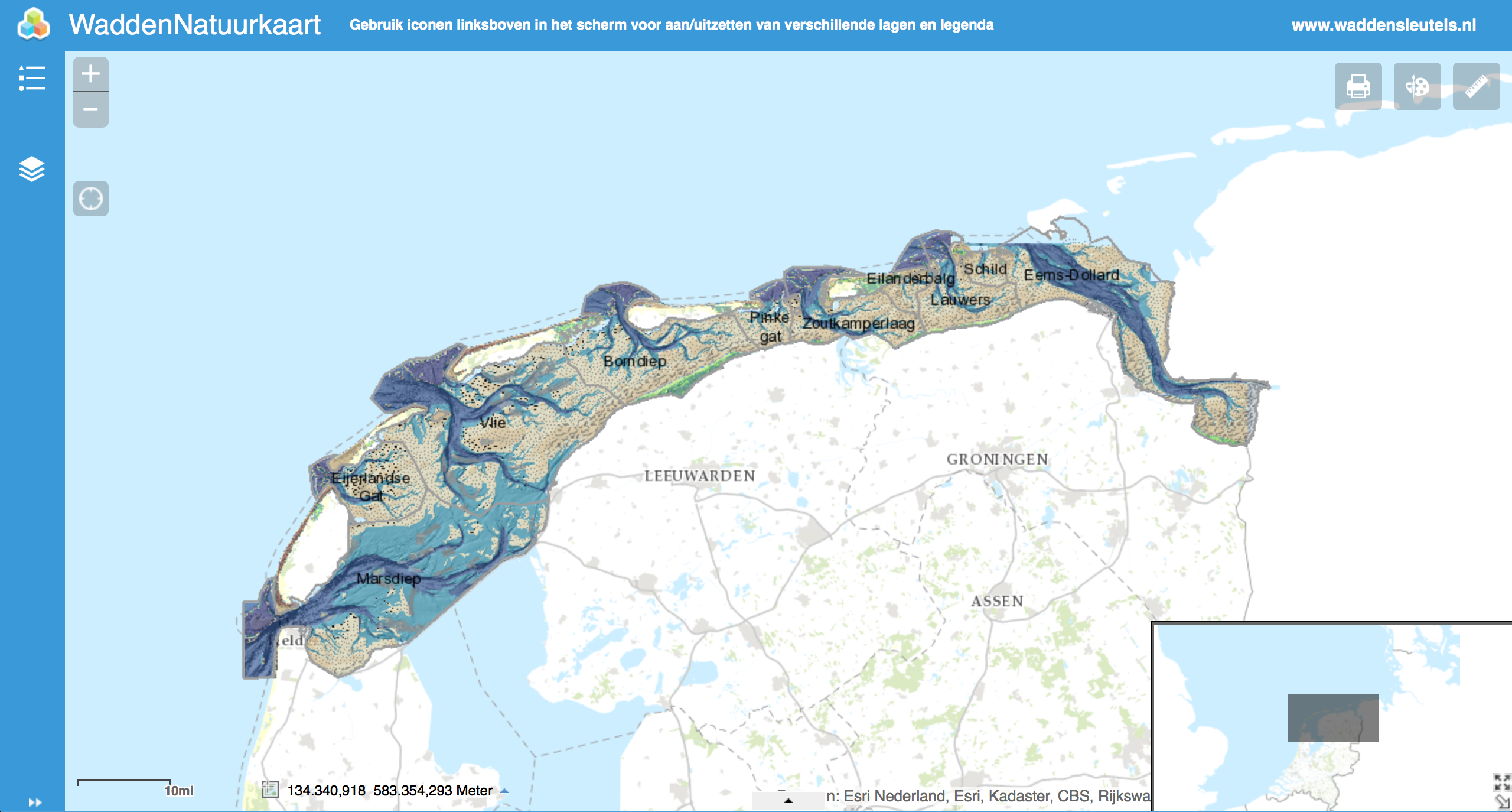
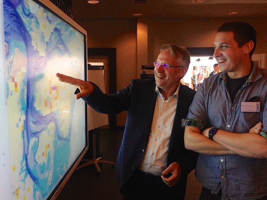
The Wadden Natuur kaart (Wadden Sea Nature Map) is now online: this is one of the publications of the Waddensleutels project on which I worked in the last 2+years. You should definitively explore and test it. For example; activate the benthos hotspot layer (upper left) and see which areas are most interesting as foraging areas for birds. Or check out where intertidal musselbeds occured for 5 years or more (in last 17 years). Or combine a map of shrimp fishery intensity and biodiversity. Our newly developed habitat map allows you to do these analysis per habitat type. Have a go at it. Use this interactive map to make your own map using just your web browser, print it or download it or continue in a GIS program. In the photo you see Han Olff & Sander Holthuijsen exploring the map at a large touch screen during the symposium in Leeuwarden.
More Waddensleutels publications here
Symposium: Wadden Sea foodweb & role of ecosystem engineers
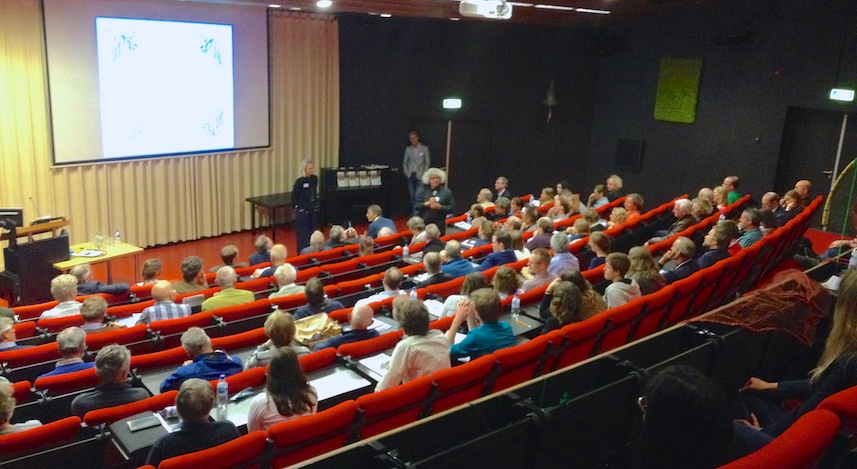
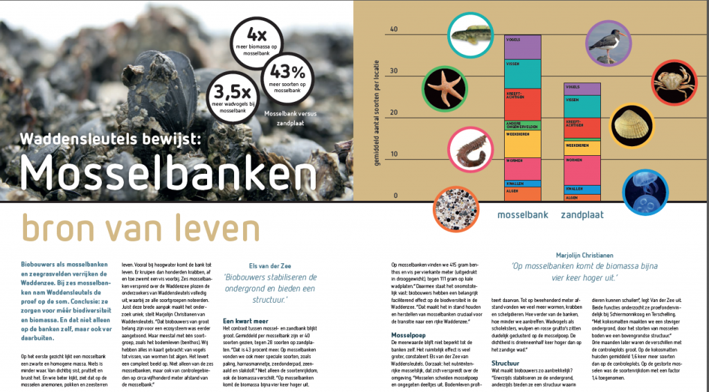
The Waddensleutels project finished 16 april 2015 with a symposium in Leeuwarden, and with that also my 1st post-doc project. Topics here were: Which measures should we take to increase the area of musselbeds in the Dutch Wadden Sea & what is the current foodweb stucture and state (and how is this affected by the presence of mussel beds)? We learned that mussel beds are of vital importance for the Wadden sea. Musselbeds increased the biomass of benthos, fish and birds upto 4 times compared to bare surrounding areas. Mussel beds really are the foundations of life in the Wadden Sea.
These results can be found in our scientific report & glossy
Fieldwork Derawan 2014 photo series
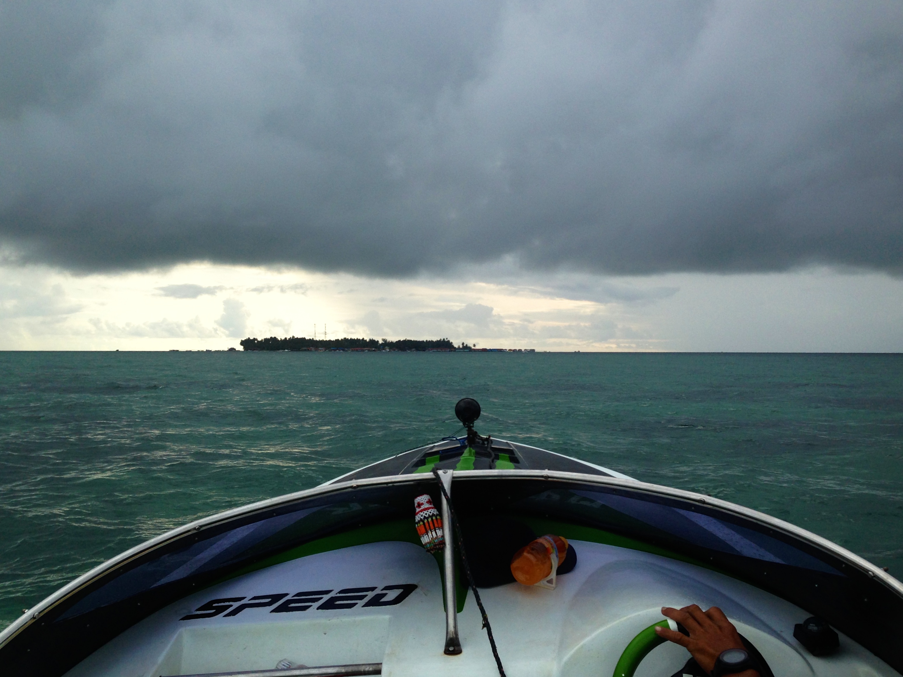
I had the opportunity to go back to Derawan for 3 more weeks of fieldwork, thanks to the Schure Beijerink Popping foundation. I gathered samples for food web analysis, checked the current turtle density and seagrass biomass, recaptured green turtles and made a new series of aerial photographs with a kite (with super assistant Sipke in the 1st week). I also searched from pygmy seahorses, frogfishes and lembeh sea dragons and found them all. Enjoy the photo’s and leave a comment!


Green turtles threaten their own food source in MPAs: New paper Proceedings B
Our new paper is out in Proceedings of the Royal Society B! Green turtle populations have expanded so much in Indonesia’s east coast islands marine protected areas that they are adopting new feeding habits, degrading the ecosystem and threatening their own conservation. Read more about “Habitat collapse due to overgrazing threatens turtle conservation in marine protected areas” and download the paper here.
After press coverage of the Associated Press the news has gone viral! see Washington Post, Time and others
Food Web collection Waddensleutels 2013

This summer we (the Waddensleutels team) visited all dutch Wadden Islands to collect samples for food web comparisons between mussel beds and surrounding habitats. It was a very successful operation. We collected around 1800 samples of organism that are now going to be analyzed for stable isotopes at the NIOZ, Texel. Sampling involved fishing with fykes (also during nighttime), benthos cores, algal sampling, but also measuring the height profile of the mussel bed, the hydrodynamics, mussel production and much more. We are very grateful for the help of the many volunteers that helped us! The pictures will tell you much more about the research & show some of our surprising catches, check it out:


Many thanks to Arjen de Ruiter en Peter Visser for providing some of the Pictures!
Also see this newsletter ( in dutch; nieuwsbrief Waddensleutels november 2013)