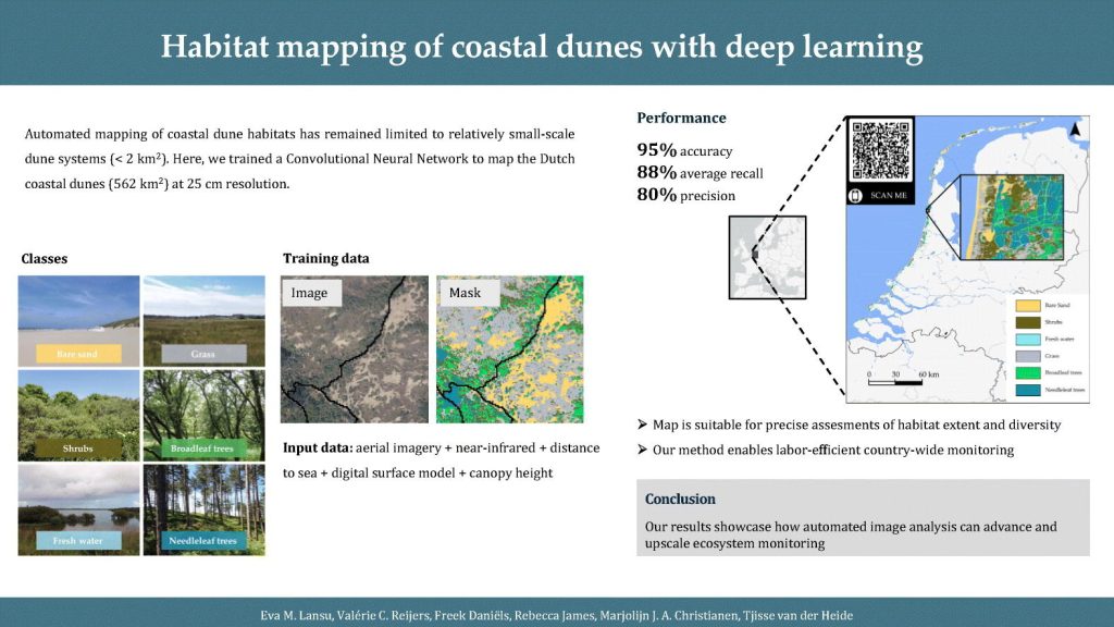
How do you monitor 560 km² of dynamic coastal dunes without spending months in the field?

Our new study – Led by Eva Lansu – shows that deep learning can help. By combining multispectral aerial imagery and elevation data, she trained a model that predicts dune habitats — from bare sand to shrubs and trees — with 95% accuracy. Using this, she mapped the entire Dutch dune system (562 km²) at 25 cm resolution.
This approach makes it possible to monitor coastal ecosystems efficiently and consistently at a national scale — essential for managing biodiversity and dune resilience in a changing climate.
The work was an interdisciplinary collaboration between remote sensing, ecology, and AI experts. Article link: https://doi.org/10.1016/j.ecoinf.2025.103444
Authors Eva Lansu, Tjisse Van der Heide, Valérie Reijers #Freek Daniels, Rebecca James NIOZ Royal Netherlands Institute for Sea Research Wageningen Environmental Research